


GPS Waypoints Navigator
4.7725.00 Reviews
App Specs
- Version
- 9.36
- Updated On
- License
- $6.99
- Downloads
- 50,000+
- Developer
- Disciple Skies Software
- Categories
- Maps & Navigation
- Platform
- Android
Screenshots
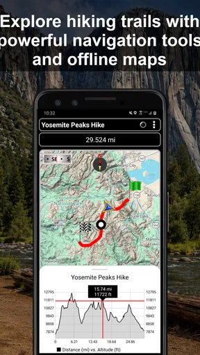
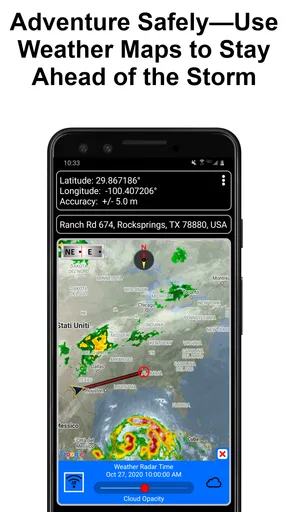
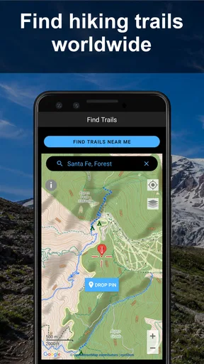
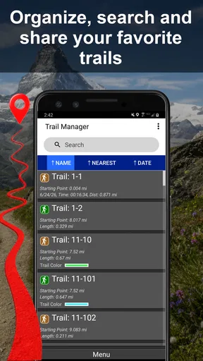
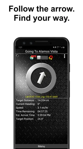
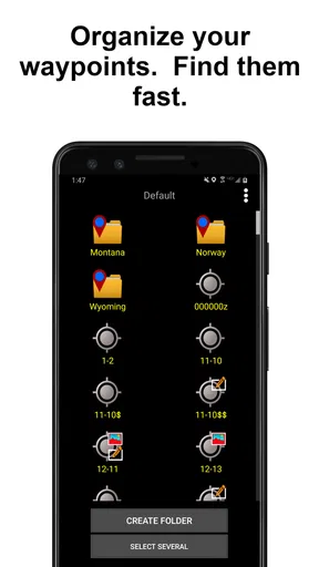
 Analysis by AppCompare
When I try a navigation app for hiking or off-road travel, I care about more than whether a blue dot moves across a map. I want to know what happens when the trail disappears, whether I can prepare before leaving home, and how much control I keep over the information I create. GPS Waypoints Navigator is built for that more deliberate style of travel. It is an Android navigation app from Disciple Skies Software, aimed at hiking, marine trips, and off-road adventures rather than ordinary city commuting.
My first impression is that this is a tool for people who think in locations: a campsite, a trail junction, a fishing spot, a vehicle recovery point, a dock, or a place worth finding again. That focus makes it more interesting than a conventional turn-by-turn driving app, but it also means the experience depends on whether you are willing to plan and interpret your route yourself. It does not feel like a replacement for every mapping service. It feels more like a field notebook with GPS awareness.
What kind of navigation experience does it offer?
The app’s store summary describes a navigation system for hiking, marine, and off-road adventures, while its short description presents it as a GPS waypoints navigator. Those two details explain the product better than a generic “maps” label. The central idea is not simply following a road. It is marking, revisiting, and navigating between meaningful points when the journey may not follow a neat street network.
That distinction matters in everyday use. If I am driving across town, I would normally choose an app that specializes in traffic, addresses, lane guidance, and automatic rerouting. If I am walking through a large natural area, exploring a shoreline, or driving a route where formal roads are only part of the story, I want a different set of priorities. I need to understand where I am in relation to saved locations and make decisions based on the terrain around me.
The app is available for devices running Android 6.0 or later, and its current version is 9.36. It is rated for Everyone, which makes it broadly approachable from an age-rating perspective. The price is $6.99, so I would think of it as a focused purchase rather than something to install casually and forget. The question is not whether it has the largest collection of mainstream map features; the question is whether waypoint-based navigation matches the way you travel.
Its average rating is 4.7 from around four thousand ratings, with more than seven hundred written reviews. It has passed fifty thousand installs. Those figures suggest that it has found a committed audience, although they do not remove the need to consider your own habits. A highly rated specialist tool can still be the wrong choice for somebody who wants effortless destination search and automatic guidance.
Why waypoints change the way I plan a trip
A waypoint is useful because it represents a decision or a memory, not merely an address. I might save the point where a trail splits, the place where I left a vehicle, or a safe turn toward a campsite. On the water, a saved point can help me identify a launch area or a location I want to approach again. In off-road travel, the most valuable point may be the beginning of a difficult section rather than the final destination.
Worth Reading Before You Choose

EA SPORTS FC Mobile 26 Is a Bigger Football Game, but It Takes Time

Flipboard Shows What News Apps Must Do Beyond the Feed

Switching to Android Auto Means Rethinking Your Driving Routine

Google Calendar Makes a Crowded Week Easier to Manage

Ludo King Makes the Most of the Minutes Between Plans

Baby Panda World Brings Quick Play to Modern Phones, but Its Game Library Feels Busy
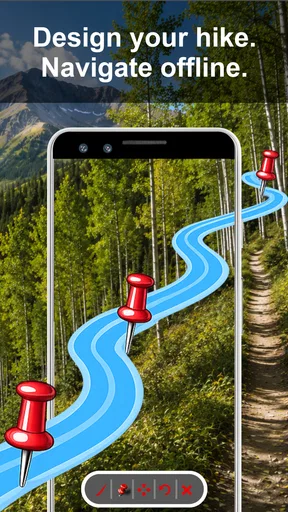
This approach encourages a better habit: I can divide a trip into recognizable stages instead of treating the whole journey as one instruction stream. Before leaving, I would review the important points in order and consider what each one means. During the trip, I can use those points as checks against my surroundings. That is especially useful when a route contains informal tracks, open ground, or water where a standard road-navigation app has little context.
One practical workflow is to save a point as soon as I encounter something I may need later, then give it a name that will still make sense after a few weeks. “North bend” is more useful than a vague label if I am returning in poor visibility. I would also avoid creating a long list of nearly identical points. A smaller set of meaningful markers is easier to interpret when I am tired, wearing gloves, or trying to pay attention to the environment.
Using it in a realistic day outdoors
Imagine I am taking a vehicle to a remote trailhead with a short hike planned afterward. I can treat the parking location as the first important reference point, then mark a trail junction, a water source, and the place where I intend to turn around. If the path becomes confusing on the way back, those points give me a way to reason about my position instead of relying only on memory.
The same pattern works for a shoreline outing. I might record the launch point, a sheltered stop, and a location that deserves a return visit. The value is not that the app magically understands every environmental risk. The value is that I have a personal set of geographic references that reflect my actual trip. That makes the app more useful as a planning companion than as a passive map displayed in the background.
There is a trade-off here. A waypoint system rewards preparation and attention. It does not remove the need to check the landscape, weather, water conditions, signage, or local guidance. I would never treat a phone screen as the only source of safety information in a remote setting. The app can support decisions, but it cannot make those decisions responsibly on my behalf.
Trust, controls, and handling sensitive location moments
Location is unusually personal. A saved point may reveal where I live, where I park, where I fish, where I camp, or which places I visit repeatedly. That makes a navigation app different from a simple calculator or flashlight. My trust depends on visible choices: what the app asks to access, whether I can decide when location is available, and whether I can manage the points I create without feeling locked into a service.
For that reason, I would review the permission prompts on my own device rather than approving everything automatically. Android lets me inspect and adjust app permissions through system settings, and I would use those controls to decide whether location access is available only while I am actively using the app or under a broader setting. The right choice depends on how I use it. Someone recording a continuous outdoor session may prefer uninterrupted access, while someone checking a saved point occasionally may want tighter control.
I also pay attention to the difference between the app and the phone’s general location settings. Turning off location at the system level affects the whole device, while changing an individual permission affects this particular app. That distinction is easy to overlook when preparing for a trip. Before heading out, I would test the chosen setup near home so I know whether the app behaves as expected with the permissions I selected.
There is another sensitive moment when I share a waypoint with another person. A location can be harmless in one context and revealing in another. A public meeting point is different from a private home, a regular campsite, or a place that identifies a personal routine. I would review the point’s name and context before sending or displaying it, and I would avoid assuming that a saved location is safe to share simply because it was created for navigation.
The app’s focused design can be reassuring because it keeps my attention on geographic points rather than surrounding social features. Still, I do not treat a specialist purpose as proof of a particular data practice. I look for the permission choices presented by my device, read any privacy information available from the developer, and make decisions based on what I can actually see. That is a healthier approach than assuming either that every location app is invasive or that a paid app automatically collects nothing.
Keeping control over my own navigation habits
Paying $6.99 changes how I evaluate the app. I am less interested in advertising-style convenience and more interested in whether the tool remains useful after the first trip. A one-time purchase can feel worthwhile when the app becomes part of a repeatable workflow: prepare points, use them in the field, and review or manage them afterward. It is less convincing if I only need a basic map once or twice a year.
I would begin with a small test trip before depending on it for a demanding outing. I could create several waypoints in familiar surroundings, walk or drive between them, and see whether the labels and navigation cues make sense to me. This is a concrete way to discover whether the interface suits my eyes and habits. It also prevents a common mistake: learning a navigation tool for the first time in an unfamiliar place where a confusing screen has real consequences.
Another useful habit is separating essential points from temporary ones. A permanent collection might include a vehicle, home base, or recurring launch area. Temporary points might describe one day’s route. Keeping those roles distinct makes the app easier to use over time and reduces the chance that a cluttered list hides the point I actually need. I would also periodically remove locations that no longer serve a purpose, especially if the device is shared with family members or used for several different kinds of travel.
Account expectations are worth considering too. I prefer to know whether an app can be used directly on the device or whether it pushes me toward creating an account or synchronizing information elsewhere. I would follow the screens shown during setup and choose only the services I genuinely need. If my main goal is local waypoint navigation, I would avoid enabling optional sharing or connected features unless they clearly improve a specific trip.
This is also where the app may not suit everyone. A person who wants automatic cloud synchronization across several devices may prefer a mainstream mapping platform designed around accounts and shared places. A group that coordinates live positions may need a dedicated outdoor communication tool. GPS Waypoints Navigator makes more sense for someone who values direct control of personal points and is comfortable taking responsibility for organizing them.
Where the app is stronger than ordinary map alternatives
Compared with a typical city-mapping app, this tool is better aligned with trips where a destination does not have a clean street address. A regular map is excellent at finding businesses, calculating road routes, and handling familiar urban journeys. It can feel awkward when my destination is simply “the bend after the old track” or a location I want to remember from a previous outing. Waypoints give that kind of place a practical identity.
Compared with a paper map, the phone-based approach is more immediate for checking my position and managing personal points. I do not have to estimate my location solely by reading contours or landmarks. The compromise is dependence on a charged device and a clear enough screen. I would carry a backup plan for serious trips, because electronic navigation is not a substitute for preparation, orientation skills, or appropriate equipment.
Compared with a general-purpose hiking app, the appeal here is its narrower emphasis on GPS waypoints and varied outdoor contexts, including marine and off-road use. A different hiking service may be preferable if my priority is discovering popular trails, reading a large community’s route recommendations, or receiving social updates. I would choose this app when I already know the places I want to navigate between and want the tool to stay centered on those points.
One non-obvious advantage of that narrower focus is mental clarity. When I am outdoors, I do not always need more content, recommendations, or notifications. I may simply need a reliable way to relate my current position to a handful of decisions I made before leaving. A waypoint-centered workflow can reduce the temptation to keep browsing and help me return to the actual journey.
Limitations I would consider before paying
The first limitation is the learning curve created by flexibility. A tool that can serve hiking, marine, and off-road situations may expose concepts that are unnecessary for a casual walker. If I only want a pleasant route through a city park, the app could feel more deliberate than needed. I would not recommend buying it solely because it has a high rating; I would buy it because I expect to use saved geographic points repeatedly.
The second limitation is responsibility. A waypoint tells me where a point is, but it does not guarantee that the route between points is safe, legal, open, or suitable for my vehicle or boat. Conditions can change, and a GPS position can still be misunderstood. I would use the app alongside current local information and common-sense checks, particularly on water or remote terrain.
The third limitation concerns device readiness. Even a well-designed navigation app is less useful if the phone is low on battery, difficult to read in bright sunlight, or exposed to rain without protection. Before a longer trip, I would charge the device, carry power if appropriate, and make sure I can operate the phone without constantly stopping. These are not failures unique to this app, but they affect whether its strengths are available when needed.
I would also keep my expectations realistic about replacing other navigation resources. The app can be a strong personal waypoint tool, but it should not automatically become my only map, emergency reference, or communication method. People who want a complete travel ecosystem with traffic, places, reviews, transit, and shared live location may be happier with a broader service. Its specialist character is the reason to choose it, and also the reason to skip it if those are not your needs.
My recommendation for careful outdoor users
After looking at the app through the lens of control and trust, I see a sensible choice for Android users who regularly navigate by meaningful locations rather than ordinary addresses. The developer, Disciple Skies Software, has kept the product centered on a clear problem: using GPS waypoints for hiking, marine travel, and off-road exploration. That clarity is more valuable to me than a long list of unrelated extras.
I would recommend it to a hiker who returns to the same wilderness areas, an off-road driver who needs to remember access points and difficult sections, or a boater who wants a personal set of locations to revisit. I would also recommend a short practice session before a serious outing, careful permission choices, and a habit of reviewing saved points before sharing them. Those steps make the app fit into a responsible navigation routine rather than becoming a source of false confidence.
I would skip it if my navigation needs are almost entirely urban, if I expect polished automatic directions without preparation, or if I need a heavily connected social and synchronization platform. In those cases, a mainstream maps service or a specialized group-travel product may be a better match. The $6.99 price is reasonable only when the waypoint workflow solves a recurring problem for me.
My cautious verdict is that this is a focused, practical navigation companion rather than an all-purpose map. Its best quality is the way it turns personal locations into usable trip references across hiking, marine, and off-road settings. Its biggest weakness is that it asks me to participate: I must prepare, interpret, protect my device, and make sensible privacy choices. For the right traveler, that is not a drawback but the point. I would choose GPS Waypoints Navigator when I want more control over where I am going and why each saved place matters.
Pros
- Works offline after maps and waypoint data are downloaded.
- Supports importing and exporting common GPS file formats.
- Accurate waypoint recording with useful coordinate details.
- Helpful for hiking
- camping
- geocaching
- and outdoor navigation.
- Can save custom locations for quick access during future trips.
Cons
- Offline map downloads may require considerable storage space.
- Some advanced navigation tools may be limited to paid features.
- Battery usage can increase during long trips with GPS enabled.
- Map coverage and detail may vary significantly by region.
- The interface may take time to learn for first-time users.
FAQs for GPS Waypoints Navigator
What is GPS Waypoints Navigator used for?
GPS Waypoints Navigator is designed for marking, saving, organizing, and navigating to specific geographic locations, commonly called waypoints. It can be useful for hiking, camping, boating, fishing, surveying, travel, outdoor photography, and returning to a parked vehicle. The app focuses on waypoint-based navigation rather than turn-by-turn city driving, so it is best suited to users who need to reach or record precise outdoor locations.
Does GPS Waypoints Navigator work without an internet connection?
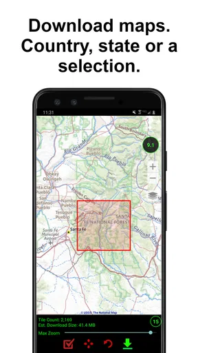
The app can generally use your device’s GPS or location services to determine your position without requiring a continuous mobile-data connection. However, offline functionality may depend on the features you use. Previously saved waypoints can usually remain available, while map images, online map layers, address searches, or route information may require internet access. It is advisable to prepare your waypoints and download any available map data before entering an area with weak coverage.
How accurate is the location and waypoint navigation?
Accuracy depends primarily on your phone or tablet’s GPS hardware, satellite visibility, weather and terrain conditions, and possible interference from buildings, trees, or cliffs. In open areas, the device may provide a reasonably precise position, but it should not be treated as professional surveying equipment. The app can guide you toward a saved waypoint, yet the final distance and direction may change as your location updates. Always use visual judgment and appropriate outdoor safety practices.
Can I save, edit, and share waypoints in GPS Waypoints Navigator?
The app is built around managing saved locations, allowing users to create waypoints from their current position or another selected location and keep them organized for later use. Depending on the installed version and device, you may also be able to edit waypoint details, add names or notes, and export or share location data. Before relying on the app for an important trip, test the available import and export options with a sample waypoint.
Is GPS Waypoints Navigator suitable for hiking, boating, or emergency navigation?
It can be a helpful supplementary tool for outdoor activities because it lets you record locations and navigate back toward them. Nevertheless, it should not be your only navigation or emergency resource. Battery life, poor satellite reception, damaged devices, incorrect waypoint data, and software limitations can all create problems. Hikers and boaters should carry suitable paper charts or maps, a compass, backup power, and any specialized safety equipment required for their environment.


